Geographic Navigator: Find Text, Photos, and Film from each Location
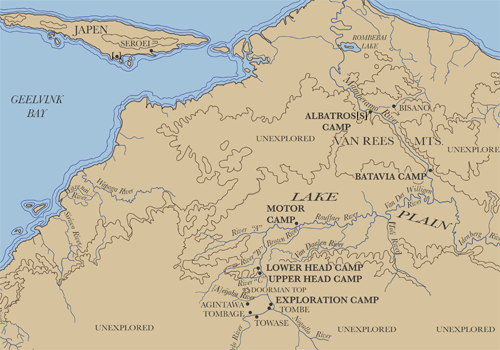
Map 2: "Map of the Mamberamo River, Netherlands New Guinea"
~
Previous Page
Soeroei (Soeroe), Japen
Mamberamo River
Albatross Camp (Base Camp)
Papuans of Bisano
Batavia Camp
Van der Willigen River
Junction of the Rouffaer and Van Daalen Rivers
Rouffaer River
Motor Camp
Brown River
Head Camp (Lower & Upper)
Overland Trail/Upper Rouffaer/Nogullo River
Explorators Camp/Tombe Village
Tombage
Agintawa District
View Other Maps
Map 1: Map of the Dutch East Indies (later Indonesia)
Map 2: "Map of the Mamberamo River, Netherlands New Guinea"
Map 3: "The Country of the Nogullo Pygmies"